



SAN DIEGO — If you look back on the hiking columns I’ve written for the San Diego Union-Tribune, you’ll often see a mention of the native chaparral and coastal sage scrub vegetation that covers a great deal of our local landscape.
I comment on it because it’s a scenery I have grown to love deeply. Not flashy, but steady. Hardy. In the cool winter months it shines brightly, lemonade berry blooming and the black sage fragrant. And in the summertime, when it may look dry and dead upon first glance, flowers of the buckwheat cast a reddish hue across the hillsides and the laurel sumac stands firm, seemingly unfazed by the heat.
The vegetation is often what excites me most about a hike — that, along with pointing out the nearby peaks and local landmarks that I can see from the trail.
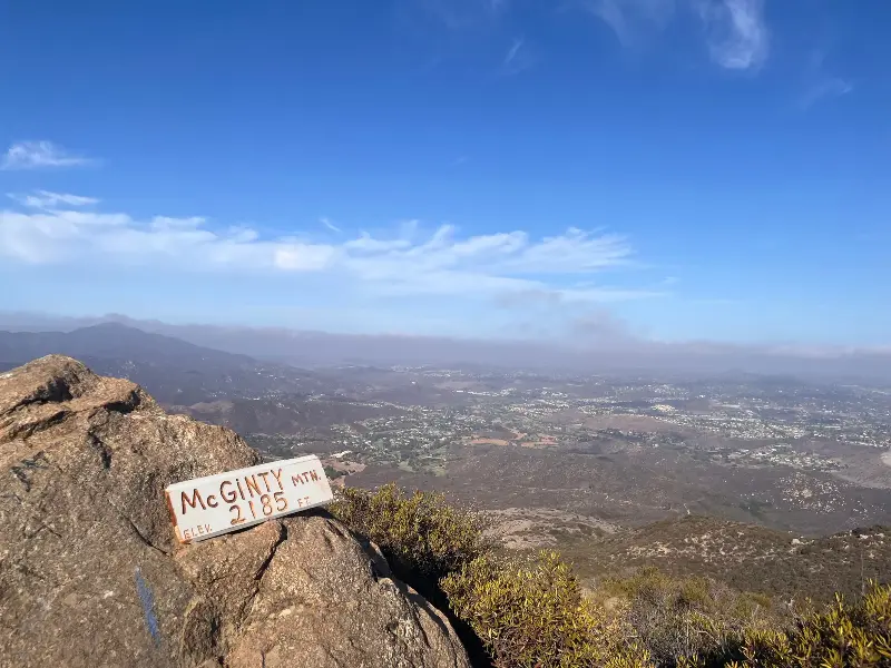
I experienced both on this week’s roughly 5-mile hike up McGinty Mountain, a 2,183-foot peak in Jamul. I learned after my hike that McGinty is also home to red-colored gabbro soils, which can support a rare set of native plants: Parry’s tetracoccus, dehesa bear grass, mountain woolly blue curls and endangered San Diego thornmint.
Even within the habitats that are so familiar, there is room to find something new.
Overall, I would fully recommend McGinty Mountain. But it is important to hike early in the morning, at least during the summertime, to avoid as much of the heat as you can. I was the first hiker on the trail at 7 a.m. and the sun began baking down just an hour later. The route is entirely exposed and is mostly an uphill climb.
To begin, park at the trailhead on Jamul Drive, northwest of Mexican Canyon Road. You can find it on Google Maps. There’s a spacious parking lot.
The trail is easy to follow as it heads north. It begins with a gradual incline but soon gets quite steep as you continue on. For the first half of the hike, you can peer down at huge mansions that sit on the hillside below.
Near the half-mile point, hikers are met with a handful of switchbacks that guide them up the mountain. There’s also a chance to see an old mine, though it’s fenced off. Just before reaching a mile, the trail begins to flatten, giving hikers a small break, though rolling hills continue for the next half-mile. Along the way, handmade trail signs mark the path.
From 1.8 to 2.4 miles — and especially during the final push to the summit — the trail is steep, and I had to take a few water breaks. But I also knew that the faster I hiked, the sooner I’d get to the peak where I could properly rest.
As far as views from the top go, this one is pretty dang good. While some clouds blocked the view to the ocean, I could still see the local peaks: El Cajon and Viejas mountains, Mount Helix, Mount Miguel and Sycuan Peak. There were plenty of boulders to sit on, and even a chair someone hauled up for weary hikers. The best part was the crew of dragonflies that danced around the summit.
I’m convinced climbing a mountain is the perfect way to start a day.